
Secret Places in California Most Tourists Miss (I Found These by Getting Lost)
I have a confession: the best places I’ve ever visited in California weren’t on any “Top 10” list. I found most of them by taking a wrong turn, asking a gas station attendant for directions, or just stubbornly refusing to follow the same route everyone else was taking.
My first trip to California was exactly what you’d expect — Hollywood Boulevard (disappointing), Santa Monica Pier (crowded), Yosemite Valley in peak July (honestly, a parking nightmare). I had a great time, don’t get me wrong. But I left feeling like I’d seen California the way you’d see it through a tour bus window. Real, but not real, you know?
So I went back. And then again. And somewhere along the way, I started ignoring the tourist guides and just… exploring.
Here’s what I found.
Alabama Hills, Lone Pine — The Desert That Hollywood Forgot to Tell You About
Most people blow through Lone Pine on their way to Death Valley or Mammoth Lakes without stopping. That’s their loss.
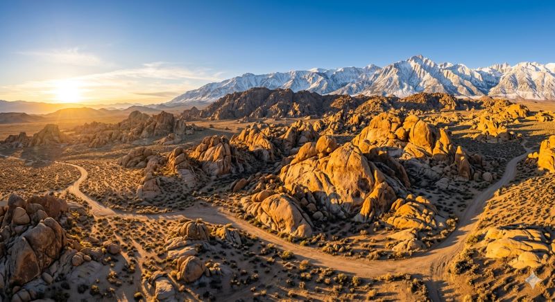
Alabama Hills sits right outside this small Owens Valley town, and it looks like something a special effects team built. Massive, rounded orange boulders stacked on top of each other against a backdrop of the snow-capped Sierra Nevada. It’s absolutely surreal, and the weird part? It’s free to enter, open 24/7, and almost never crowded.
What most people don’t know is that hundreds of Western films were shot here — everything from old Gene Autry serials to Gladiator used these rocks as a backdrop. There’s a free “Movie Road” map you can pick up at the Lone Pine Film History Museum (worth a quick stop) that shows you exactly where famous scenes were filmed.
I spent a sunrise morning here once with maybe three other people around. I watched the light hit those rocks and turn everything gold and pink while Mount Whitney — the tallest peak in the contiguous US — loomed behind me. It was genuinely one of the most beautiful things I’ve ever seen, and nobody on Instagram had told me about it.
Practical tip: Camp at the BLM land right in the hills. It’s dispersed camping, totally free, just don’t leave trash. Pull up the free BLM map or use the app Gaia GPS before you go.
Mono Lake, Lee Vining — Alien Landscape Two Hours from Yosemite
People drive past Mono Lake every single day on Highway 395, heading to Yosemite’s east entrance. They glance at it and think “huh, pretty,” and keep driving.
Big mistake.
Mono Lake is one of the oldest lakes in North America — about 760,000 years old. It has no outlet, so over millennia, minerals have concentrated in the water and formed these ghostly limestone spires called tufa towers that rise right out of the lake. The place looks like you’ve landed on the moon, or maybe in a Salvador Dalí painting.
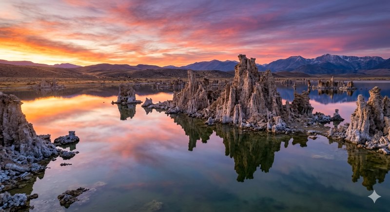
When I first walked down to South Tufa Beach and stepped between those towers at golden hour, my brain genuinely couldn’t process what I was looking at. They can be 30 feet tall. The lake itself is eerie and still. Brine shrimp live in it (which is why the bird life is insane — I’ve seen thousands of phalaropes spinning in the shallows).
The Mono Lake Committee Information Center in Lee Vining is worth stopping at. The folks there actually care about this place, and they’ll tell you about the best times to visit, the legal fight that saved the lake from LA’s water diversions, and where to go for the best tufa views.
Practical tip: Go in the morning when the water is calm and the reflections are perfect. Bring bug spray in summer — not because it’s dangerous, just annoying near the lake’s edge.
Limekiln State Park, Big Sur — The One Without the Instagram Line
Big Sur is stunning. It’s also absolutely packed, especially at McWay Falls, which has become one of those Instagram spots where you basically queue up to take the same photo as 10,000 people before you.
Here’s what fewer people do: drive another 20 minutes south and pull into Limekiln State Park.
It’s a tiny, beautiful campground and trail system right where a creek meets the Pacific. There are actual 19th-century lime kilns (old industrial furnaces, basically) tucked into the redwoods — they were used to process limestone back in the 1800s and are remarkably well preserved. You walk through a forest, past a waterfall, and suddenly there are these massive stone structures just… sitting in the woods. It feels like a forgotten world.
The beach at Limekiln is mostly cobblestone and often has good tidepools. You’ll have it nearly to yourself on a weekday.
I made the mistake once of assuming I could walk in without a reservation on a weekend. I couldn’t. The park is small and fills up fast.
Practical tip: Book ahead at ReserveCalifornia.com. Weekday visits are much easier. The hike to the kilns and waterfall together takes maybe 45 minutes round trip and is totally worth it.
Salvation Mountain, Slab City — The Most Surreal Place in America
Okay. This one is hard to explain without sounding like I’ve lost my mind.
Outside of Niland, in the Sonoran Desert of Southern California, there is a man-made mountain made entirely out of adobe and paint. It’s covered in religious folk art, Bible verses, hearts, flowers, and colors that don’t look real in real life. It was built by a man named Leonard Knight over decades — just one guy with a vision and a lot of paint.
Right next door is Slab City, an off-grid community of people living on old military base slabs. No water, no electricity, no rules — just people who decided to opt out of conventional society. It’s wild, a little eerie, and oddly fascinating.
I went on a January morning — the desert in January is perfect, by the way, not too hot — and spent a couple of hours just wandering around Salvation Mountain. The whole thing is maintained by volunteers now. There’s no admission fee, though they accept donations to keep it going.
I want to be clear: this isn’t for everyone. The drive is long, the area around Slab City is rough around the edges, and you should 100% tell someone where you’re going before you head out there. But if you’re up for it, it’s one of the most genuinely original things you’ll ever see.
Practical tip: Go between October and March — summer temperatures out there can hit 115°F. Bring water. A lot of it. Use Google Maps to navigate to “Salvation Mountain, Niland, CA” and it’ll get you there.
Pfeiffer Beach, Big Sur — The Purple Sand Beach Most People Can’t Find
There’s a beach in Big Sur with purple sand. Purple. Not a little bit purple — visibly, unmistakably purple in patches, caused by manganese garnet washing down from the surrounding cliffs.
Pfeiffer Beach is technically accessible to the public but almost everyone drives past the unmarked turnoff. It’s on Sycamore Canyon Road, just south of the Big Sur post office, and the turnoff is easy to miss if you’re not looking for it. The road down is narrow and you have to pay a small day-use fee ($12 last I checked).
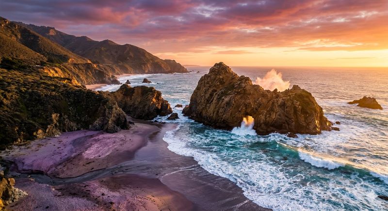
But the beach itself? There’s a massive keyhole arch in the sea stack offshore that frames the sunset perfectly. The sand really does turn purple in certain light. And it’s just not on the main tourist circuit, which means it’s quieter than McWay Falls by a mile.
I’ve been here twice — once in overcast weather (still beautiful, very dramatic) and once in golden-hour sunshine (honestly life-changing). Both were worth the drive.
Practical tip: Only passenger vehicles can fit on the road — no RVs. Come at low tide for the best beach access. Parking is limited and fills up by 10am on summer weekends. Go early.
Common Mistakes California Tourists Make (That I Made Too)
Planning everything around Instagram spots. Half of California’s magic is in the unexpected find. Build flexibility into your trip.
Visiting peak attractions in July and August. June, September, and October are almost always better. The weather is still great, the crowds drop off significantly, and prices come down.
Assuming you need a rental car for everything. You absolutely do outside of cities, but within San Francisco and LA, you’ll spend more time parking than exploring.
Not downloading offline maps. Cell service disappears fast in the Sierras, Big Sur, and the desert. Download your route on Google Maps or Gaia GPS before you leave wifi range.
Skipping the north coast. Mendocino, the Lost Coast, Patrick’s Point State Park — all spectacular, all massively undervisited compared to the south. The ruggedness is the whole point.
conclusion
California is enormous. It’s bigger than most countries, with more climatic variety than most continents. You genuinely cannot see it all in one trip, or five.
The best thing I ever did was slow down. Spend three days somewhere instead of one afternoon. Talk to locals at the diner or the campground — they always know something the guidebooks don’t. Ask the ranger what their favorite trail is, not the most popular one.
The California most tourists miss isn’t really hidden. It’s just quieter, a little less marked, and waiting for the people willing to turn off the main road.
Those people always have better stories.
Visited and written from personal experience. Always check current park hours, reservation requirements, and road conditions before you go — California’s parks update their policies frequently.
Last updated by 2026